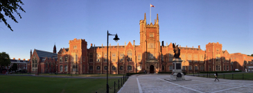
The wonderful conference "Geostatistics for Environmental Applications" (GeoENV) in Belfast ended a couple of weeks ago. Queen's University hosted us and served as a spectacular location for the conference and the conference dinner. The nice atmosphere between the attendants has been an outstanding characteristic of this conference series that makes it worth for me to attend regularly! Certainly, I had outstanding scientific conversations during the conference. The final pints at the pub on the final evening demonstrated wonderfully how similar we are in our thoughts, perceptions, and understanding of scientific, societal, and political issues across our diverse backgrounds.
A common theme across many presentations were various approaches to use secondary data to improve the estimation of the variable of primary interest. Gregoire Mariethoz uses as much information as he can from remote sensing (e.g., various channels of remotely sensed images) to fill in gaps between raster images or in observed time-series of discharge. Jaime Gomez-Hernandez fuses precipitation measurements from radar images and rain-gauges. I use categorical (e.g. land-cover) information and other related real-valued measurements to better map groundwater quality parameters (the related paper was accepted during the conference). I also showed our approach to fuse different measurement types with different support and uncertainty. In discussions it became quite obvious that incorporating the varying quality of measurements into one model is one area of research that need our attention.
Peter Atkinson showed a related and simpler version of Peter Diggle's triangle: